

The Pacific coast from southern Mexico to Panama serves up dramatic volcanic landscapes, safe anchorages, and warm welcomes. When travelling in either direction, two notorious gap winds keep sailors honest on this journey: the Tehuantepecers on the Southern Coast of Mexico, and the Papagayos, which affect the coasts of Nicaraqua and Costa Rica. These funneled northerlies can snap from zephyr to gale with almost no notice, whipping up steep, square waves that can make you question your life choices. Thanks to modern forecasts and the “one foot on the beach” tactic, the passage has gone from “legendary terror” to “perfectly doable with patience.” Many crews wait days (or weeks) for the right weather window. Fortunately, this can be time well spent exploring ashore instead of staring at the marina pilings for days on end.
In Part 1 of this article we will discuss tips and tricks for navigating the Tehuantepec winds. Part 2 will cover the Papagayo winds and offer general passage tips.
The Tehuantepec Winds
Cold fronts over the Gulf of Mexico shove air through the narrow Chivela Pass, creating the infamous northerly Tehuantepecers (affectionately nicknamed “T-peckers” by sailors who’ve survived them). These winds rule the Gulf of Tehuantepec (Huatulco to Puerto Chiapas) from October to April, with peak nastiness from December to February: 50+ knot winds and seas that can be felt up to 250 miles offshore. From May to September the winds are almost unheard of (fewer than one day a month). The classic warning is brief squalls followed by skies so clear you can see tomorrow, while the barometer stays suspiciously stable.
Seasonality
Mid-December to February is prime time for the biggest blows. The winter season (October to March) usually delivers 15 to 20 gale-force or stronger events, each lasting a day to a week. July sometimes throws a weak tantrum, but it’s more of a grumpy sigh than a roar.
Here’s a sample NOAA/NHC weather forecast for a T-pecker:
A Storm Warning is in effect for the Gulf of Tehuantepec. The next gap wind event across the Tehunatepec region is expected by Sun morning as a ridge builds across the eastern slopes of the Sierra Madre Mountains in Mexico, behind a cold front moving across the Gulf of [Mexico]. Winds are forecast to suddenly increase to 35 to 40 kn, with seas building to 9 to 12 ft on Sun. Winds will further increase to near storm force by Sun evening, with seas building to 12 to 18 ft. Gusty winds exceeding 50 kn are possible late Sun into Mon. Then, winds are forecast to strengthen to storm force by Mon morning with seas building to 20 to 24 ft. Storm conditions and very rough seas are expected to persist through Mon night, then winds will diminish to strong gale force on Tue. Large seas generated from this very strong gap wind event will spread well away from the Tehuantepec area, with seas 8 ft or greater reaching as far west as 105W by Mon night. Marine interests transiting across or in the Gulf of Tehuantepec Sun through Tue should be aware of this upcoming gap wind event and take the necessary action to avoid hazardous marine conditions over the affected waters. Winds are forecast to diminish below gale force early on Wed. High pressure over the Great Basin will induce fresh to strong NW winds across the entire Gulf of California tonight into Mon with seas building to 6 to 8 ft across the central and southern parts of the Gulf tonight and Sun.
We spent over two weeks in Huatulco waiting for our weather window, exploring locally and then renting a car with some other cruisers to do a road trip to Oaxaca (home of mole, a Mexican specialty) and see the Monte Alban ruins.
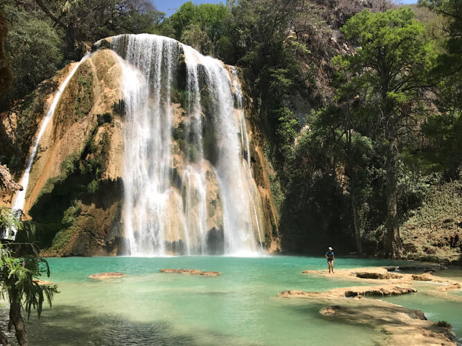
One of the many spectacular waterfalls in Chiapas, this one at Tzimol.
Tips for Crossing the Gulf of Tehuantepec
Southbound (Huatulco to Chiapas)
Stage the passage in the Bays of Huatulco (Marina Chahué or sheltered anchorages). The crossing to Marina Chiapas is ~240 NM, and the recommended coastal route adds 30–50 nautical miles.
Northbound (Chiapas to Huatulco)
Stage at Marina Chiapas, where you can get fuel, a haul-out, and full services. The crossing is the same distance in reverse. Wait for a solid window since you will need at least 48 hours of light air for the direct shot. It is possible to time a passage with a shorter window, but make sure you’re not caught out in the area around Salina Cruz, which typically sees the worst wave action. PredictWind, NOAA offshore forecasts, Windy, and PassageWeather are your new best friends.
Hug the coast (“one foot on the beach”) by sailing ¼ to ½ mile offshore (closer on safe sandy stretches) or follow the 10-fathom (60 ft / 18 m) depth contour. Either method works but by staying in relatively shallow water close to the beach limits, the fetch and bottom friction dramatically reduce wave height. The detour buys cell service, the ability to bail out and anchor (you can drop the hook just about anywhere along the beach), and the smug satisfaction of watching the big seas rage offshore while you sip coffee in peace should the forecast be wrong. A helpful coastal current usually assists southbound boats; northbound crews lose a bit but still benefit from the reduced seas. Typical run: 30 to 40 hours either way.
Cruisers swear by this route in both directions. On their blog, Peregrina says, “We were told that the key to a safe passage is to sail with ‘one foot on the beach.’” Pacific Mystic agrees, stating that, “We decided to follow the recommended approach… with one foot on the beach.”
While in Chiapas, consider taking advantage of your downtime. We rented a car to tour inland for a two-week road trip. Chiapas delivers Palenque’s Maya ruins, spectacular natural wonders like the Agua Azul waterfalls, rainbow colonial San Cristóbal de las Casas, coffee fincas, and chocolate workshops — far better than polishing the same winch for the tenth day in a row.
From the Gulf of Tehuantepec to the Papagayo Zone
Winds lighten noticeably once you pass the gulf. The 100 to 150 NM hops take you past Guatemala, which most cruisers skip in either direction. Guatemala has few protected anchorages, minimal facilities, expensive clearing and port fees, and is therefore not a highlight. The typical play is an overnight passage straight to (southbound) or from (northbound) Bahía del Sol.
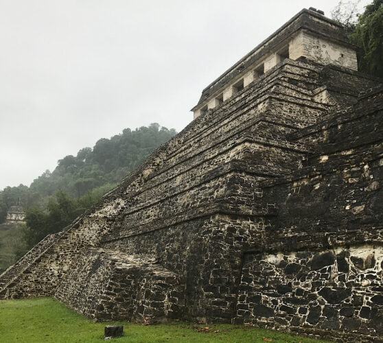
The foreboding Maya ruins at Palenque
El Salvador Highlight
Bahía del Sol is pure cruiser catnip, thanks to Bill and Jean, former cruisers who have lived on Cordoncillo island for over 20 years and call themselves “campground hosts for cruisers.” Email them in advance of your arrival. Bill charts the surf daily and gives you the exact safe crossing window; he rides in the panga with the pilot and talks you across the bar on VHF. His calm voice is legendary in both directions.
Inside the estuary, tie up, anchor, or pick up a mooring ball. Then head to Vidri Hardware: “almost any hardware, plumbing, and electrical item you want… plus a small but dangerous boat section.” Many sailors walk in for one fitting and walk out with a backpack full of hardware-store treasure — a real treat after the slim pickings in Mexico. Super Selectos supermarket likely has a few foods you haven’t seen in a while, too.
Don’t miss the legendary Pupusa Saturdays, organized by Bill and Jean — homemade pupusas, cold Pilsener, cruiser stories, and that unbeatable El Salvador hospitality. Crews in both directions often stay weeks, using the safe moorings to explore inland or just enjoy the vibe.
While here, take advantage of the CA-4 free-movement agreement (El Salvador–Guatemala–Honduras–Nicaragua). Rent a cheap car, leave the boat, and road-trip four countries on one car rental.
Nicaragua Bonus
From Marina Puesta del Sol, grab a 40-minute taxi to the Flor de Caña distillery in Chichigalpa. Take a tour: Regular $10; VIP $100 with private barrel tastings. Many crews call it the perfect “we survived/are challenging the Papagayos” reward in either direction.
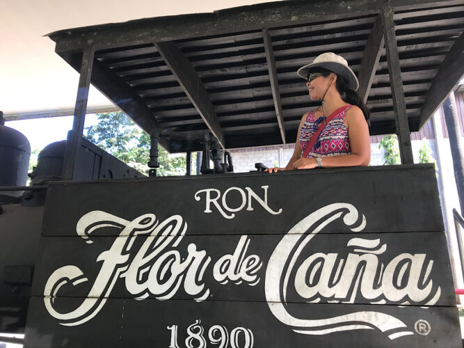
Debra getting in the spirit for our Flor de Caña rum tour.
Join us in Part 2 for tips on navigating the Papagayo winds, which affect the Nicaraguan and Costa Rican coasts.


After looking at our crossing of the Tehuantepec in April 2001, I found that we had obviously found a good crossing. We were able to cross 337 miles directly across the bay in 3.5 days with 2/3 sailing and 1/3 motoring in mostly 4-11 knot westerly winds. We left from a bay just north of Huatualco we cruisers named “Osprey Bay” to Puerto Quetzal, Guatemala. We agree with Bob Murray that Guatemala on the Pacific side was not a good place to stay since they seemed then to have no place for little boats to be checked in.